|
 |
|
Wisconsin Scenic Travel Guide, Waterfalls, Campgrounds, Hiking, Lodging & Things to do
Discover Wisconsin's South Shore of Lake Superior

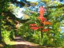
Fall Color at Potato River Falls
See Wisconsin Lake Superior Fall Color Drives
If you are heading east from Duluth, Mn on US 53, the first stop on the Wisconsin portion of the Lake Superior Circle Tour Route is just over the bridge in Superior, Wisconsin. Waterfall enthusiasts will want to take a short side trip south of Superior to visit Pattison State Park, a Wisconsin state campground with hiking trails and the state's highest water fall. (Click here for directory to more campgrounds) Returing to Superior and US 53 and heading east, you'll intersect with Wisconsin highway 13, the preferred scenic route to the Bayfield Peninsula where several quaint villages are located along this route: Port Wing, Herbster, and Cornucopia, WI.

Devil's Island Sea Caves
Video

Travel Map - Wisconsin South Shore
Click on the links in the above map for more info on interesting things to see and do along Wiscosnin's Lake Superior Shore
Best Bayfield and Wisconsin Lake Superior Campgrounds

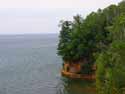
Shortly after "Cornie" there are two mainland visitor attractions of the Apostle Islands National Lakeshore: Meyers Beach, and Little Sand Bay. Eventually one reaches the Wisconsin crown jewel of the Lake Superior tour - the town of Bayfield with lots of things to see and do, and its sister village on nearby Madeline Island. We found the Apostle Island Cruise a worthwhile scenic attraction and an affordable way to see the islands.
Beyond Bayfield, Wisconsin the Lake Superior tour offers several interesting Wisconsin attractions to discover. Among them are: some great lakeside campgrounds in Washburn, the Northern Great Lakes Visitor Center in Ashland, and the Bad River Lodge and Casino at Odanah along US highway 2. Travelers willing to make a little side trip detour south can find some worthwhile waterfalls and hiking opportunities at Morgan Falls/St. Peter's Dome, Copper Falls State Park, and Potato Falls. In the fall this is an especially worthwhile detour for scenic fall color. Returning to US highway 2 heading towards Hurley, take Wisconsin Highway 122 for a scenic drive along the lakeshore and see the impressive Superior Falls at the Wisconsin-Upper Peninsula border - best viewed from the Michigan side.
Gas Saving Tips - Enjoy a unique vacation along the shores of Lake Superior for less money than you'd imagine


)
)
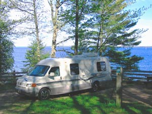
Camping on the Bayfield Peninsula
While camping at Washburn's Memorial Park, looking out our tent door over Chequamegon Bay, we caught a spectacular moonrise one night, followed by an equally impressive sunrise the next morning. > > >
![]() More Info on Camping in Bayfield-Ashland Counties
More Info on Camping in Bayfield-Ashland Counties
Here's some more pages with camping, hiking, and things to do in the Chequemagon Bay, Apostle Islands, and the Bayfield Peninsula area:
> > Bayfield Wisconsin
> > Ashland Wisconsin
> > Apostle Islands National Park
> > Madeline Island, Apostle Islands
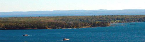
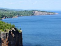
View of Madeline Island from Bayfield, Wisconsin.
)
Waterfalls, Scenic Hiking,
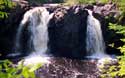
Camping at Copper Falls State Park
Lake Superior Wisconsin Camping, Campground & RV Links
- Bayfield and Ashland Area Camping
Our Recommendations of nice campgrounds, many with views of Lake Superior - Pattison State Park
State's highest waterfall, nature center, 9 miles of hiking trails, 59 campsites, RV (18 electric hookups & dump station) and tent camping (showers and flush toilets in summer) - Amincon Falls State Park
Waterfalls, hiking, picnic area, tent camping . Camp sites mostly rustic, but well spaced and layed out. - Copper Falls State Park
Great hiking trails, pretty waterfalls, nice picnic areas, swimming beaches, and full service campground. - Brule River State Forest
Rustic tent camping, canoe camping, trout fishing. - Herbster Clover Township Campground
On Lake Superior, for RVs and tents. Lake views, with some great tent sites right on the beach. Some electric sites. Dump station. - Saxon Harbor Campground
On Lake Superior, 15 miles west of Ironwood, Michigan. 32 Campsites: 27 with electric hookups for RVs and 5 primitive campsites for tents. Large harbor boating, picnic area and beach.
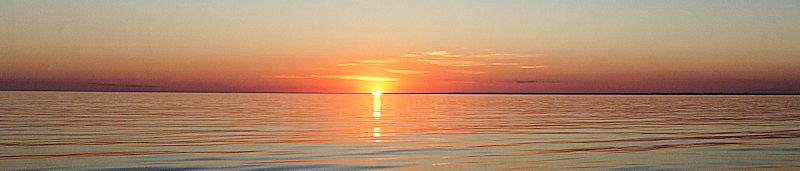
More Lake Superior Sunsets
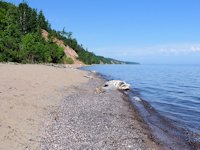
Along highway 13, near the western end of the Bayfield Peninsula, is Wisconsin's most northern town - Cornucopia, Wisconsin. It offers charming artisan shops, fish markets, charter fishing, beach walking and . . . beautiful sunsets > > >
A few more photos taken on the Cornie Beach
)
)
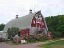
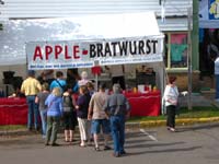 Bayfield Apple Festival - October
Some Wisconsin traveling and outdoors links:
Wisconsinmade.com - Wisconsin books, gifts and products
Wisconsin Online - An online guide to events, attractions, and recreation
CWD Watch - Articles on the Deer Hunting crisis in Southern Wisconsin
Advantage Rate Motel Hotel-Resort Lodging in Wisconsin Cities
SuperiorTrails.com - Reinhold Development - 2023

- Lake Superior Circle Tour
- Wisconsin Travel
- Wisconsin Travel Guide
- Bayfield WI
- Big Top Chautauqua
- Cornucopia WI
- Apostle Islands
- Madeline Island
- Big Bay State Park
- Amnicon Falls Park
- Ashland, WI
- Copper Falls State Park
- Fall Color Scenic Drives
- Lake Superior Ice Caves
- Superior, WI
- Superior Burgers & Pizza
- Best Superior Wi Pubs
- Superior Wi Dragonboat Race
- Washburn, WI
- Wisconsin Golf
- Wisconsin Travel Map
- Wisconsin Water Falls
- Wisconsin Winter Events
- Wisconsin Fall Color
- Minnesota North Shore
- Ontario Travel
- Michigan Upper Peninsula
- Travel Resources
- Agates & Beach Rocks
- About Us

Bayfield Holiday Events & Activities
Duluth Holiday Events and Fun.
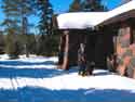
Winter - Michigan UP
Winter - Wisconsin Winter - Minnesota
Winter - Sault Ste Marie.
See our guide to interesting and fun things to see and do on Madeline Island.
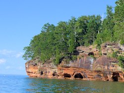
See photos from our recent Apostle Islands
Sea Caves cruise.
Apostle Islands Sea Caves Hiking Trail is about a 3.5 mile round trip from Meyers Beach to the Bayfield Sea Caves
Lake Superior Travel Directories
Minnesota Travel
Wisconsin Travel
Upper Peninsula
Ontario Travel
Things to see and do on Madeline Island
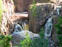
Copper Falls State Park is near Mellen, Wisconsin.
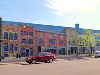
Ashland Mural Walk is an interesting attraction in nearby Ashland, Wisconsin.
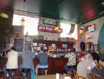
Fun things to see and do including great Burger & Pizza Bars in Superior Wisconsin
 Lake Superior Dragon Boat Festival is one of the top midwest dragonboat race and festivals.
Scenic Fall Color Drives in Ashland Area
Orchard Touring
Take a scenic drive of
farms and orchards in the Bayfield area.
![]()

Hotel, Motel Lodging
Ashland, Superior, Ironwood, Wisconsin South Shore
![]()

Lake Superior Circle Tour Road Map & Guide to Travel Attractions around Lake Superior.
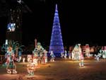
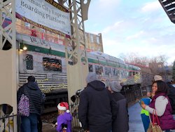
Duluth's amazing Bentleyville Duluth Christmas Lights Village.
How to recognize Lake Superior Agates and Beach Rocks.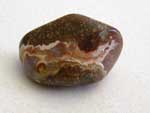
Best Wisconsin Lake Superior Agate Beaches
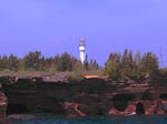
See the lighthouses on an Apostle Islands Cruise.
Copper Falls State Park
is near Mellen, Wisconsin.
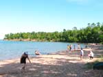
Enjoying the great swimming Beach Big Bay State Park on Madeline Island.
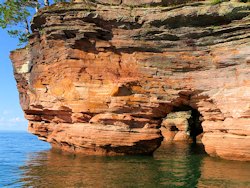
The Sea Caves of the Apostle Islands National Park are a major attraction.


See our
Reviews of Best Wisconsin golf courses on Lake Superior.