|
 |
|
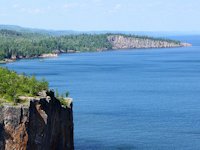
About Lake Superior Facts & History
Some interesting things you may not have known about Lake Superior (Gitche Gummee*), our fabulous inland sea.
How old is Lake Superior? What is the depth of Lake Superior? Answers to these questions and more.
Top 5 Facts about Lake Superior
How old is Lake Superior?
Minnesota's Sea Grant program provides us some clues to the first question. The beginnings of Lake Superior trace back a billion years! . . . when molten basalt erupted in a rift from near present day Detroit stretching to Northern Minnesota. "Billions of tons of molten rock" accumulated deep beneath the earth's surface for 22 million years. Some point during this time period eventually the tipping point was reached where the surface of Mother Earth could no longer support the weight and the surface began to sink . . . and the Lake Superior basin began to form.
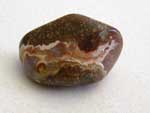 The basalt rock that formed this original basin is most apparent in the North Shore of Superior - in Minnesota and Ontario. Here Basalt outcroppings are abundant. (Learn more about Lake Superior Rocks & Agates here) Shallow seas flooded the southern portion of the basin and deposited sand and muck which eventually formed the sandstone formations found in the Bayfield Peninsula - Apostle Islands and Pictured Rocks National Lakeshore parks. That was 500 million years ago - according to the Minnesota Sea Grant research.
This historical perspective on Gitchee Gumee reminds me of a book most fascinating, combining more in depth geology with tourism exploration, I found at the bookstore in Ontario's Lake Superior Provincial Park: "Roadside Geology of Ontario: North Shore of Lake Superior." I discovered it near the end of the northern leg of our last circle tour trip, but next time it will be among my guide books for the journey. Some of the oldest rocks in the world exist along the Lake Superior shoreline in Ontario.
What's the depth of Lake Superior?
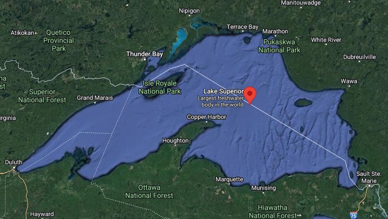
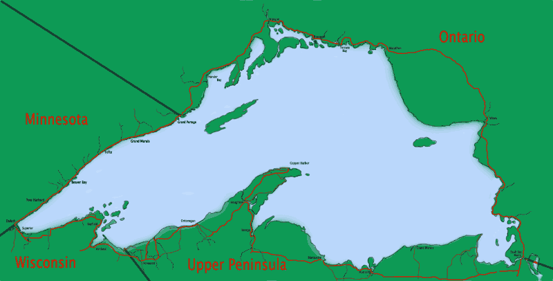
For some time reliable sources claimed 1332 feet. But more recently that figure has been revised to a little under 1300 ft. What explains the difference? Silting in of the deepest hole? More sophisticated measuring technology? Dunno. Yet this fact remains: Whether 1333 feet or 1295 feet deep, it contains more water than all of the other Great Lakes combined! And it accounts for 10% of the world's surface fresh water. This surface area (31,700 square miles) is greater than the combined acreage of the states of Vermont, Massachusetts, Rhode Island, Connecticut, and New Hampshire.
How Big is Lake Superior?
Lake Superior is the largest freshwater lake in the world, based on surface area, and the third largest in volume exceeded only by Lake Baikal in Siberia and Lake Tanganyika in Africa. There is enough water in Lake Superior to cover the entire land mass of North and South America with a foot of water!
If you were able to walk the shoreline of Lake Superior, your trek would cover 2,726 miles. About 90% of that shoreline is forested and relatively uninhabited. Even though it is the largest freshwater lake in the world, you might be surprised to learn that the total population of All the cities, towns, villages, and settlements around the lake is less than 800,000 people. You largely escape the traffic you find in urban areas and get to enjoy the slower pace of small towns and villages that periodically dot the unspoiled shoreline around the lake.
How Clear & Clean is Lake Superior?
The average underwater visibility of the Lake is 27 feet and in some parts of the lake it is 100 feet! Suffice to say it is the cleanest of the Great Lakes.
Water comes into Superior from over 300 streams and rivers and exits into Lake Huron via the St. Mary's River - which by the way 2000 years ago was more of a channel than a river because at one time the levels of Lake Huron and Lake Michigan were higher, much closer to the level of Superior than they are today. Unfortunately levels in Lake Superior have been falling recently with evaporation taking more out than the streams, rivers, and springs put in. An interesting fact you might not think would make a difference - warm winters where the lake doesn't freeze over also hurt the lake - because the open water allows higher evaporation. And as you'd expect lower levels of rainfall in the summer hurts too. Lower snowfall in some recent winters haven't helped either.
How Cold is Lake Superior?
The average annual water temperature is a chilly 40 degrees. Even though it is cold, the lake rarely completely freezes over. The huge volume of water acts as thermal mass moderating the cold of winter and the hot of summer. This mass also contributes to lake effect snowfalls, affecting primarily the Michigan Upper Peninsula and the Ontario eastern shore. But in the middle of summer there are sandy shallow water beaches where you can swim. (you can see some swimmers in photos on our Madeline Island Big Bay State Park page)
These facts were obtained from information provided by the Northern Great Lakes Visitor Center and the Minnesota Sea Grant program
*Gitche Gummee or Gitchee Gummee is derived from the Objiwe name for Lake Superior - Gichigami and originally came from Longfellow's poem The Song of Hiawatha and much later popularized by Gordon Lightfoot's song The Wreck of the Edumund Fitzgerald. From Wikipedia
![]() Master Lake Superior Travel Map and Guide
Master Lake Superior Travel Map and Guide
Weather Around Lake Superior
 Want an idea of the weather to expect during your trip around Lake Superior?
I like accuweather.com for getting a handle on the weather around Lake Superior. If I am planning for a trip at least two weeks away, I search for a city of my interest and then use their Monthly tab to get info on daily averages. Do this for several cities along your desired route and you'll get an idea of what to expect. When you are looking at the current month, it will show a forecast for the remainder of the month and the historical highs and lows for comparison. For example here's what it shows for Duluth, Mn for the month of September.
You can also scroll down the page of our Weather Report for Lake Superior Region or our Lake Superior Region Snow Report webpage for some links to current weather reports for some popular destination areas around Lake Superior.
The Northern Great Lakes Visitor Center

Want to learn even more about Lake Superior and the ecological environment that surrounds it? Be sure to visit the Northern Great Lakes Visitor Center, a few miles west of Ashland, Wisconsin off US Highway 2.
Site Map and Travel Directory Index
Go Here for Site Search & Superior Circle Tour Travel Directory
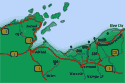
- Lake Superior Circle Tour Map -
- Lake Superior Circle Tour Mileage -
- Seasonal events & featured articles on Lake Superior Travel -
SuperiorTrails.com - Reinhold Development - 2023
Privacy Policy

- Lake Superior Circle Tour
- Minnesota North Shore
- Wisconsin Travel
- Upper Peninsula Michigan
- Michigan Upper Peninsula Travel Directory
- Camping in Upper Peninsula
- Keweenaw Peninsula Scenic Drives
- Copper Harbor - Keweenaw
- Black River Harbor Scenic Area
- Porcupine Mountains
- Pictured Rocks National Park
- Fall Color Porcupine Mountains
- Pictured Rocks National Park
- Tahquamenon Falls State Park
- Winter Events Upper Peninsula
- Ontario Travel
- Travel Resources
- SuperiorTrails.com Travel Planner
- Guide to Superior Travel Maps
- Lake Superior Travel Blog
- Lake Superior Golf Course Directory
- Lake Superior Campground Directory
- Finding Lake Superior Agates
- Fall Color Drives
- Fall Color Reports
- Scenic Byways Blog
- SEARCH this site
- Superior Travel Bookstore
- Snow & Weather Reports
- Agates & Beach Rocks
- About Us
 Lake Superior Camping
& Campground Directory
Best Camping along Lake Superior.
 Lake Superior Travel Directories
 Minnesota Travel
Wisconsin Travel
Upper Peninsula Travel
Ontario Travel
See our Directory of our favorite Upper Peninsula Scenic and Recreation areas.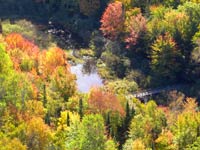
 Don't miss experiencing Duluth's Canal Park, Shopping and Entertainment District.
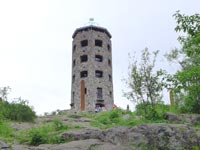
Duluth's Enger Park Tower provides a panaramic view of the city of Duluth.
See our reviews on Best Hiking and Camping Guides around Lake Superior.
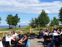 Enjoying lake breezes and views at the Duluth Canal Park Brewery Beer Garden - Canal Park.
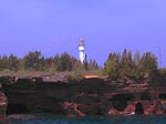
See the lighthouses on an Apostle Islands Cruise.
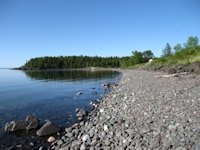
Best Agate and Rock Picking Beaches around Lake Superior
Travel Information |
Motels & Hotel Directory |

Lake Superior Circle Tour Road Map & Guide to Travel Attractions around Lake Superior.
How to recognize Lake Superior Agates and Beach Rocks.
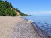
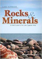
See Our Reviews of the best guides to Lake Superior Agates and Beach Rocks.
Enjoying lake breezes and views at the Canal Park Brewery Beer Garden - Canal Park.

 See our guide to interesting and fun things to see and do on Madeline Island.