|
 |
|
Apostle Islands National Lakeshore
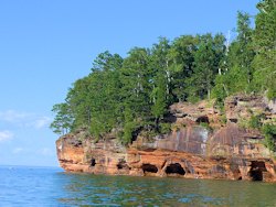
Meyers Beach - Bayfield Sea Caves

Looking towards Sea Caves from Meyers Beach
Apostle Islands National Lakeshore
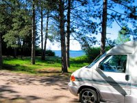
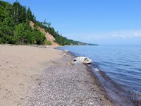
At the extreme western end of the mainland portion of the Apostle Islands National Lakeshore, about 5 miles east of Cornucopia, Wisconsin, is Meyers Beach Recreation Area. The Park Service has recently paved the road into the beach and created an ample paved parking area. While the beach itself is quite attractive and offers a nice spot for swimming, a picnic, or beachcombing, its popularity is mainly due to something about 2 miles away: the Sea Caves of the Bayfield Peninsula.
See photos of the
Apostle Islands Sea Caves
Apostle Islands Travel Directory
Apostle Islands Travel
Apostle Islands Cruise
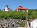
Raspberry Island Lighthouse
Bayfield Sea Caves Boat Tour
Winter Bayfield Ice Caves
Apostle Islands Links
Madeline Island
Madeline Island Historical Museum
Big Bay State Park
Cornucopia, Wisconsin
Bayfield - Main Directory Page
Bayfield Camping
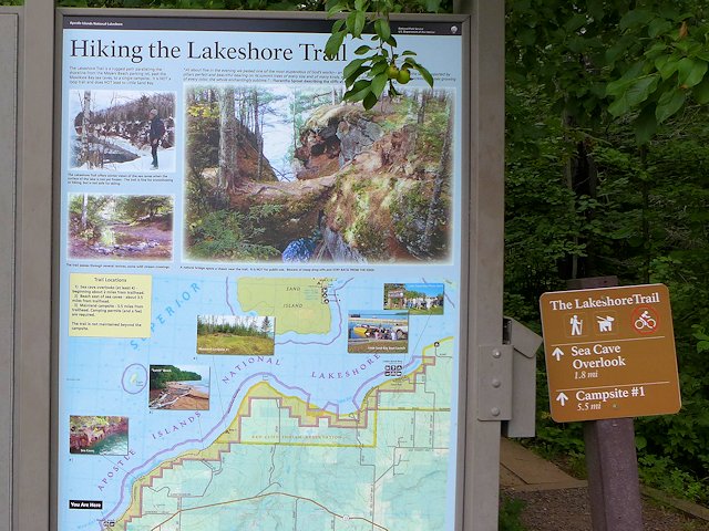
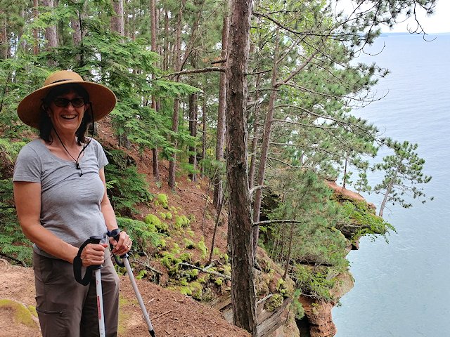
The Apostle Islands Park Bayfield Sea Caves make Meyers Beach a popular departure point for Kayakers wishing to explore the caves. The caves can also be seen by taking a 1.8 mile hike up the Lakeshore Trail. (Note for backcountry campers: there is a camping area 2 miles down the Lakeshore trail near Sand Point.) Having no kayak, Jo and I chose the land route to see the caves.
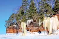
See the Apostle Island Park Snow & Ice Caves in the Winter.
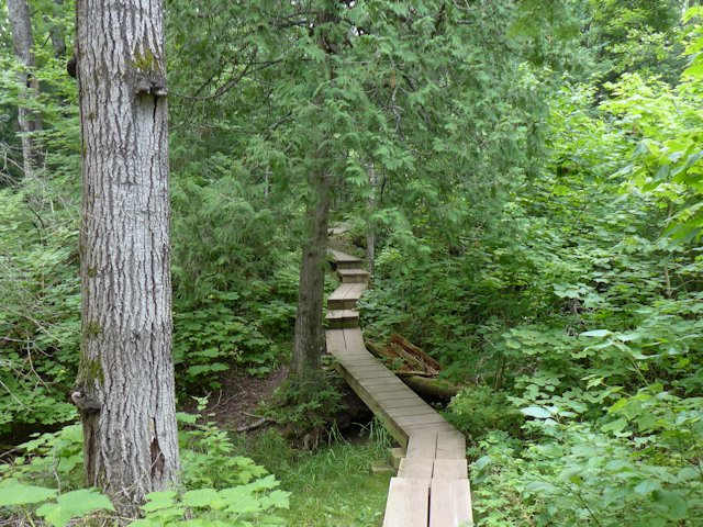
Although called The Lakeshore Hiking Trail, views of the lake were rare until we got near the caves. The hiking trail runs near the lakeshore, but the woods were too thick to see the lake clearly. These woods with its variety of tree species would be especially attractive during the fall color season. The trail was rated moderately difficult because of the frequent up and down undulations; however, we found it well maintained with stair steps wherever the trail got steep. The trail crossed a number of creeks but all but one were dry due to the drought like conditions at the time. But even if the trail had been a drudge of a hike, the reward at the end, the Sea Caves, were worth it.
![]()
Lakeshore Hiking Trail - Sea Caves
)
Hans gets a welcome drink in the one creek that wasn't dry. > > >
)
< < < After hiking for about an hour through woods too thick to see the lake clearly, we get a scenic lake view.
)
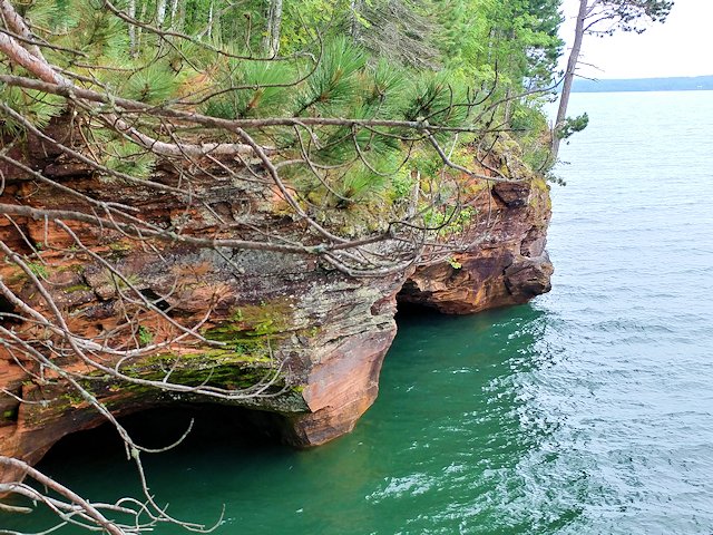
Eureka, we finally reach the Sea Caves > > >
)
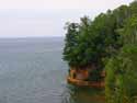
< < < Looking down into one of the caves.
More Sea Cave views from above)
)
)
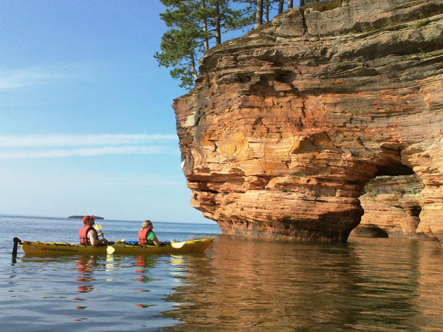
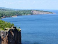
< < < We walked further east on the trail and the Sea Caves continued along the shoreline, but the views of them weren't as good from above. Here they can be best seen from the water, by Kayak or an Apostle Islands Boat Cruise. The island in the distance in the photo is "Eagle Island."

For some great views of the caves from the "frozen water" see our pix from our wintertime visits to the Bayfield Ice & Sea Caves. > > >
)
On the return hike, we found a sand road that led to the waterfront so walked the beach back to the parking lot. So we were able to see some different scenery than the hike into the caves.
Since our hike, pictured above, several years ago, the Lakeshore Hiking Trail to the Sea Caves has been substantially improved, with bridges and board walks over rougher and wet terrain. Here's a few pix from a 2017 hike our friends Scott Savage and Lynne Herrli took out to the sea caves.
|
  |
 |
![]() See more pictures of the Mainland Sea Caves from the water.
See more pictures of the Mainland Sea Caves from the water.
![]() See a Video of Devil's Island Sea Caves
See a Video of Devil's Island Sea Caves
)
Lakeshore Hiking Trail aerial photo
Here's an aerial view from Google Maps of the Meyers Beach Apostle Islands Recreation Area and the Sea Caves hiking trail.
Winter Hiking to the Sea Caves


![]() Photos by
Jason Reichel
Photos by
Jason Reichel
Some winters Lake Superior doesn't freeze over enough to safely walk on the "water" to see the Caves covered in ice sculptures. But you can still see Mother Nature's works by snowshoeing or hiking the Lakeshore Hiking Trail in the winter.
Kelley Linehan, Marketing Director at the Bayfield Chamber of Commerce & Visitors Bureau, recommends hikers wear layered clothing as there are several up and down portions of the trail that will help heat up your circulation so you may find yourself "de-layering" to cool off! Generally the path is well trodden enough that you won't necessarily need snowshoes. But check conditions before you go in the event recent snowfalls have made snowshoes advisable. In any case you'll want somes sturdy boots (ice crampons might come in handy too) and pack some bars and water or beverages as the round trip could take up to 3 hours.
Need some help with outfitting or a check on conditions, phone or e-mail the Chamber for recommendations. (715) 779-3335 or chamber@bayfield.org
The Winter Trailhead runs from the Meyers Beach parking lot. There is a $3 park service parking fee.
Other Ways to see the Caves
You can also rent a kayak or book a boat tour from Cornucopia, Wisconsin by Lost Creek Adventures or Good Earth Outfitters (see our links on the Cornie page).
Kayakers and boaters planning to visit the sea caves can get important information on wave conditions at the Sea Caves Watch Website.
- An interesting article and slide show on the Apostle Islands by Katie Thurmes
![]() - Apostle Islands Travel Links - visiting the Apostle Islands National Lakeshore Park and historic Madeline Island.
- Apostle Islands Travel Links - visiting the Apostle Islands National Lakeshore Park and historic Madeline Island.
![]() Things to see and do in Bayfield, WI - events, festivals, special attractions.
Things to see and do in Bayfield, WI - events, festivals, special attractions.
![]() Bayfield Apple Festival - Northern Wisconsin's oldest and most popular fall festival.
Bayfield Apple Festival - Northern Wisconsin's oldest and most popular fall festival.
![]() Cornucopia Wisconsin - quaint seaside village west of Myers Beach.
Cornucopia Wisconsin - quaint seaside village west of Myers Beach.
SuperiorTrails.com - Reinhold Development - 2023

- Lake Superior Circle Tour
- Wisconsin Travel
- Wisconsin Travel Guide
- Bayfield WI
- Big Top Chautauqua
- Cornucopia WI
- Apostle Islands
- Madeline Island
- Big Bay State Park
- Amnicon Falls Park
- Ashland, WI
- Copper Falls State Park
- Fall Color Scenic Drives
- Lake Superior Ice Caves
- Superior, WI
- Superior Burgers & Pizza
- Best Superior Wi Pubs
- Superior Wi Dragonboat Race
- Washburn, WI
- Wisconsin Golf
- Wisconsin Travel Map
- Wisconsin Water Falls
- Wisconsin Winter Events
- Wisconsin Fall Color
- Minnesota North Shore
- Ontario Travel
- Michigan Upper Peninsula
- Travel Resources
- Agates & Beach Rocks
- About Us
 Lake Superior Camping
& Campground Directory
Best Camping around Lake Superior.
Things to see and do in Bayfield & the Apostle Islands.
 See our guide to interesting and fun things to see and do on Madeline Island.
See photos from our recent Apostle Islands
Sea Caves cruise.
Apostle Islands Sea Caves Hiking Trail is about a 3.5 mile round trip from Meyers Beach to the Bayfield Sea Caves
Lake Superior Travel Directories
Minnesota Travel
Wisconsin Travel
Upper Peninsula
Ontario Travel
 Apostle Islands Raspberry Island Lighthouse Cruise & Tour
Things to see and do on Madeline Island
Orchard Touring
Take a scenic drive of
farms and orchards in the Bayfield area.
![]()

Hotel, Motel Lodging
Ashland, Superior, Ironwood, Wisconsin South Shore
![]()

Lake Superior Circle Tour Road Map & Guide to Travel Attractions around Lake Superior.
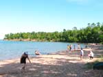
Enjoying the great swimming Beach Big Bay State Park on Madeline Island.
How to recognize Lake Superior Agates and Beach Rocks.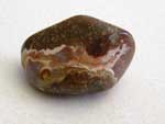
Best Wisconsin Lake Superior Agate Beaches
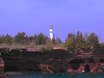
See the lighthouses on an Apostle Islands Cruise.
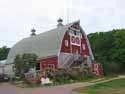
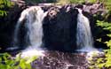
Copper Falls State Park
is near Mellen, Wisconsin.
Enjoying the great swimming Beach Big Bay State Park on Madeline Island.

See our
Reviews of Best Wisconsin golf courses on Lake Superior.