 |
 |
|
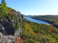
Fall Color Porcupine Mountains State Park,
Hiking and Backpacking Trails

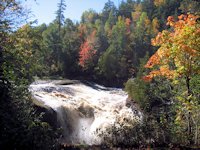
Overlook Falls along the Little Carp River Hiking Trail in the Porcupine Mountains
More Pages on visiting Porcupine Mountains State Park
Porkies Home Page, Summit Peak & Union Bay Campground
- Camping in the Porkies
Waterfalls Presque Isle River
Lake of the Clouds Scenic Overlook
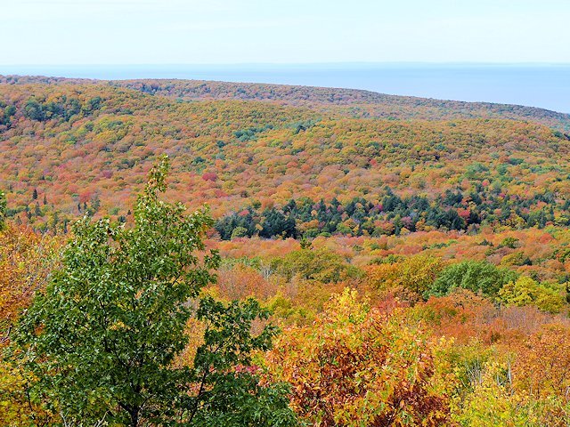
FALL COLOR in the Porkies
More Scenic Photos of the Porkies
Park Details & Maps
See our winter porkies page for maps, pictures and info on downhill skiing, snowshoeing, and cross-country skiing in the Porcupine Mountains.
Day Hikes, Short Scenic Hikes & Backpacking
The Porcupine Mountains Wilderness State Park offers some of the best hiking and backpacking trails in the upper Midwest (ranked #2 by Silent Sports Magazine). It covers 60,000 acres and is Michigan's largest state park. The extensive network of trails through the park provide a wide-variety of experiences from short 1/2 mile hikes to scenic vistas to multi-day hikes and overnight backpacking trips. For long distance hikers, there is network of backcountry campsites as well as the popular rustic cabins that you can reserve for your hiking adventure.
If you are interested in overnight backpacking, we recommend getting Jim DuFresne's Guide to the Porcupine Mountains. For daytrippers, we'll profile some of our recommended trips below.
![]() See our links to other Porcupine Mountains attractions at the bottom of this page.
See our links to other Porcupine Mountains attractions at the bottom of this page.
Short Scenic Hikes
)
)
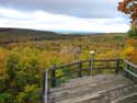
Summit Peak Trail & Observation Deck
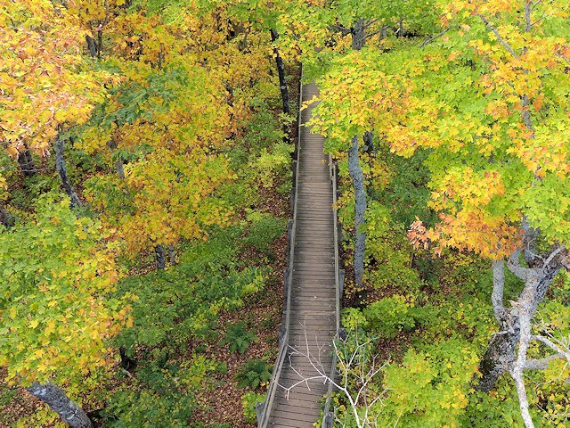
Summit Peak. The Summit Peak trail head is reached from the South Boundary Road. The hiking trail to the observation tower on Summit Peak is a half-mile walk uphill with some rest benches along the way. I've seen motorized wheelchairs negotiate the trail, but unfortunately the last part of the trail is a boardwalk with some stairs so some on-foot travel is required to get to the top of the peak, as well as to climb the tower's stairs. There is an intermediate observation deck before you get to the top giving a nice view (see picture above) prior to reaching the peak. At 1958 feet elevation, it offers quite a panoramic view of the area.
Views from the Summit Peak Tower.
![]() See more pictures and information on Summit Peak Here
See more pictures and information on Summit Peak Here
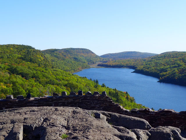
Lake of the Clouds Overlook. The trailhead parking area is located at the end of Michigan Highway 107. This "hike" is short enough to qualify as a walk. In fact the trail to the overlook is handicap accessible.
Longer Day Hikes. However the Overlook also serves as a trailhead for and connects to the much longer Escarpment Trail (4.3 miles one way) which is also quite scenic, with sheer cliffs and sharp elevation changes and the Big Carp River Trail (9.6 miles one way) that follows a ridge above the river for several miles and then drops to the river's edge and runs all the way to the mouth of the river at Lake Superior. Shorter out and back hikes to selected scenic overlooks along these two trails are possible.
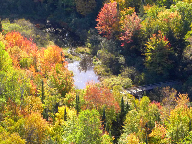
The North Mirror Lake Trail (3.8 miles one way) is also served by the Lake of the Clouds trailhead. In the picture to the left, taken from the scenic overlook, the Mirror Lake Trail crosses the Big Carp River.
![]() See more pictures and information on Lake of the Clouds Scenic Overlook
See more pictures and information on Lake of the Clouds Scenic Overlook
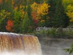
East and West River Trails. The West River Trail is 1.1 miles long and the East River Trail is 1.2 miles. You can combine them for a loop of about 3.5 miles by traveling a short distance along the South Boundary Road. The trailhead parking lot is in the Presque Isle unit Recreation Area, which also includes a picnic grounds and rustic campground. The trail network also accommodates shorter hikes including a loop from the parking lot to the bridge, then along a boardwalk adjacent to the river to Manabezho Falls and return via an overland route. I'd estimate this loop to be about a mile.

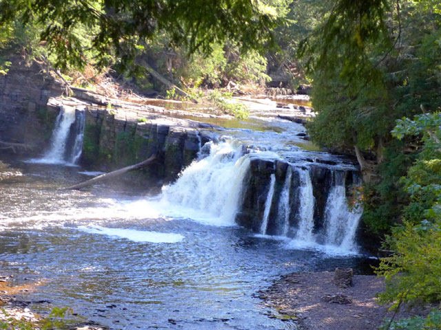
These trails include sections going through old-growth timber, river views and scenic overlooks of three attractive waterfalls and the cascades that run under the bridge. Along with Lake of the Clouds and Summit Peak, taking the waterfall trails and boardwalks are a must-see attraction of your visit to Porcupine Mountains Park.
![]() See more pictures and information on the Presque Isle Waterfalls here.
See more pictures and information on the Presque Isle Waterfalls here.
Other Shorter Day Hikes
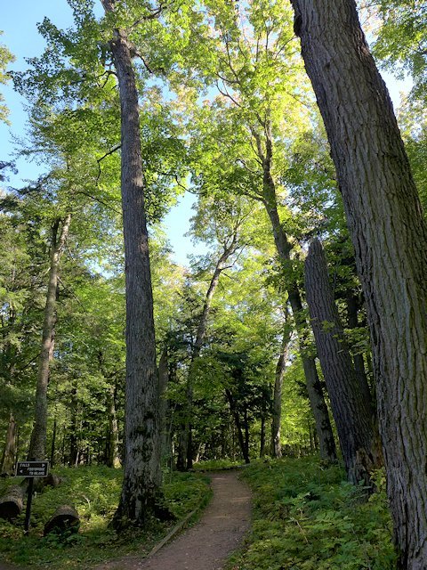
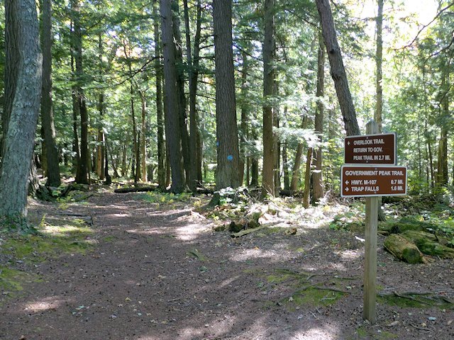
The Overlook Trail is a 2.7 mile loop accessed from the Government Peak Trailhead on M-107. The trail starts .7 miles from the trailhead so the total trip out and back will be 4.1 miles. There are some steep up and down portions of the trail and as the name suggests some "overlooks" along the trail. The trail also goes through some old growth timber. It is popular because it is a loop and its length and elevation provides some decent exercise without consuming most of the day.
Trail to Trap Falls. Instead of taking the Overlook Trail you could stay on the Government Peak Trail and do an out and back hike to Trap Falls (1.6 miles one way). On the way you cross the Upper Carp River. The round trip total for this hike would 4.6 miles. More ambitious hikers could continue all the way to Government Peak (1850 feet elevation) and back for a total of 10.4 miles from the trailhead and back.
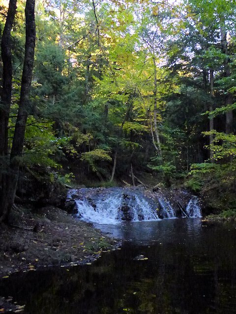
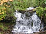
Trail to Greenstone Falls. The trailhead is at the end of Little Carp River Road off the South Boundary Road. Near the parking lot is Overlook Falls, a tiny cascade that is more impressive in the spring of the year. You cross the bridge and turn left going west on the Little Carp River Trail. This is another out and back hike. I've lost track of the distance but I don't think it is more than 1.5 miles (and maybe less) so your total round trip would be about 3 miles. As you are hiking adjacent to the river, the hike only has modest up and down stretches. You go through some older growth timber and Greenstone Falls is an attractive little waterfall. It is another 6 miles to the rivermouth on Lake Superior from this point.
Union Mine Trail. This is a short 1 mile loop with interpretative signs that runs along the Little Union River gorge. Another short interpretative trail (1.4 miles) is located adjacent to the park Visitor Center.
Union Spring Trail. This is an out and back hike. It is 1.4 miles to the pond and another .6 miles to the spring itself. Union Spring is reputed to be the second largest natural spring in Michigan. Total round trip of this hike is 4 miles.
South Mirror Lake Loop. This route combines portions of three hiking trails and provides a variety of scenery and a somewhat longer but do-able day hike. My estimate on the round-trip length is 5.5 miles. Park at the Summit Peak trailhead and take the trail to the tower. From there there is a side trail that leads down the hillside to the South Mirror Lake Trail. Turn left at the intersection and proceed to Mirror Lake (about 1.5 miles). There you cross Little Carp River coming out of Mirror Lake and join up with the Little Carp River Trail. In 1.5 miles you will intersect with the Beaver Creek Trail. Take this trail to return to the Summit Peak Trail parking lot (1.2 miles).
Other Shorter Day Hikes. If you have two vehicles or have bikes that you can post at a trailhead, there are number of one-way hikes you could do easily within a day without over-straining yourself. The Lily Pond Trail to the Little Carp River Trail to the parking lot at Little Carp Road is do-able. The Escarpment Trail from the Govenment Peak Trailhead to the Lake of the Clouds Trailhead is another. There are so many intersections of the trails, many permutations are possible. (see the maps below for more ideas)
BackCountry Cabins & Backpacking
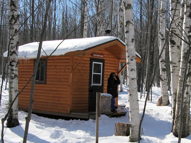
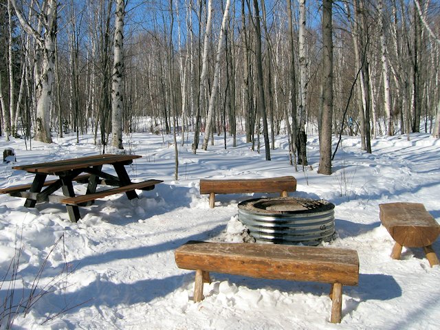
Backpackers doing multi-day hikes have a choice of backcountry tent sites and a unique network of back-country cabins.
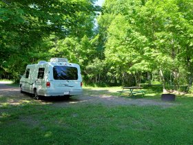
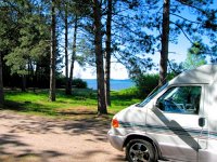
Here's two pictures of a typical back-country cabin and campsite that are sprinkled among the various hiking trails in the park. They are availabe year-round as you can see in the pictures this was taken in the middle of winter. There is a small woodstove in each unit for heating. Get more information here on Camping in the Porkies.
Hiking and Backpacking Links - Porcupine Mountains Wilderness Park
![]() Here's a full map you can print out showing the campsites, back-country rustic cabins, hiking trails, waterfalls, and other points of interest within Porcupine Mountains Wilderness State Park.
Here's a full map you can print out showing the campsites, back-country rustic cabins, hiking trails, waterfalls, and other points of interest within Porcupine Mountains Wilderness State Park.
![]() Here's a link to descriptions of several of the hiking trails
Here's a link to descriptions of several of the hiking trails
![]() Here's a link to information on renting the Rustic Cabins
Here's a link to information on renting the Rustic Cabins
![]() Here's a link to information on Wilderness Camping in the Porkies
Here's a link to information on Wilderness Camping in the Porkies
![]() Here's a link to a map of backcountry campsites and rustic cabin locations.
Here's a link to a map of backcountry campsites and rustic cabin locations.
![]() Porcupine Mountains - Summit Peak, Union Bay Campground
Porcupine Mountains - Summit Peak, Union Bay Campground
![]() Camping and Campgrounds - Porcupine Mountains State Park
Camping and Campgrounds - Porcupine Mountains State Park
![]() Lake of the Clouds Scenic Overlook
Lake of the Clouds Scenic Overlook
![]() Porcupine Mountains - Fall Foliage Color
Porcupine Mountains - Fall Foliage Color
![]() Waterfalls, Presque Isle River & Campground
Waterfalls, Presque Isle River & Campground
![]() More Scenic Porcupine Mountains Pictures
More Scenic Porcupine Mountains Pictures
![]() Porcupine Mountains - Winter Attractions
Porcupine Mountains - Winter Attractions
![]() Hiking Trail Map & Facility Info on the Porkies
Hiking Trail Map & Facility Info on the Porkies
More Porcupine Mountains State Park Resources
Michigan DNR Porcupine Mountain State Park Website
![]() Here's a link to a publication with more info on visiting the Porcupine Mountains - Porcupine Mountains Visitor.
Here's a link to a publication with more info on visiting the Porcupine Mountains - Porcupine Mountains Visitor.
More Links
Michigan Upper Peninsula
Lake Superior Circle Drive Attractions
![]() Going east towards Marquette, Munising and Pictured Rocks . . . More waterfalls, hiking pages, and scenic attractions from Munising through Tehquamenon Falls to Sault Ste. Marie.
Going east towards Marquette, Munising and Pictured Rocks . . . More waterfalls, hiking pages, and scenic attractions from Munising through Tehquamenon Falls to Sault Ste. Marie.
![]() Going west towards Black River Scenic Area . . . waterfalls, hiking, camping, rock picking.
Going west towards Black River Scenic Area . . . waterfalls, hiking, camping, rock picking.
![]() Copper Harbor & Keweenaw Peninsula
Copper Harbor & Keweenaw Peninsula
![]() Directory Upper Peninsula Travel Pages . . . on SuperiorTrails
Directory Upper Peninsula Travel Pages . . . on SuperiorTrails
SuperiorTrails.com - Reinhold Development - 2023

-
Upper Peninsula Michigan
- Michigan Upper Peninsula Travel
- Baraga, MI
- Black River Harbor Campground & Waterfalls
- Fall Color Black River Scenic Byway
- Copper Harbor, MI
- Grand Marais, MI
- Keweenaw Peninsula
- Keweenaw Peninsula Scenic Drive
- Keweenaw Fall Color
- Hancock-Houghton, MI
- Ironwood Michigan
- Marquette, MI
- Best Restaurants Marquette
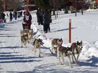
- UP 200 Sled Dog Race
- Marquette to Sault Ste Marie
- Munising, MI
- Munising Ski Snowshoe
- Pictured Rocks National Park
- Porcupine Mountains State Wilderness Park
- Sault Sainte Marie
- Tahquamenon Falls State Park
- The Soo Locks
- Upper Peninsula Camping
- Upper Peninsula Waterfalls
- Upper Peninsula Winter Events
- Travel Map Eastern Upper Peninsula
- Travel Map Western Upper Peninsula
- Fall Color Scenic Drives
- Winter Events Upper Peninsula
- Upper Peninsula Golf Courses
Winter - Michigan UP
Winter - Wisconsin Winter - Minnesota
Winter - Sault Ste Marie.
Best Upper Peninsula Campgrounds
Lake Superior Camping
& Campground Directory
Best Camping along Lake Superior.
 Tahquamenon Falls State Park and Waterfalls.
Upper Peninsula Fall Color
Tour Map
Fall Color at Porcupine Mountains State Park
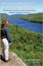
Porcupine Mountains Guide for Hikers, Backpackers, Campers and Winter Visitors
The third edition of the most comprehensive guide to the hiking trails and backcountry camping of Porcupine Mountains State Park. Great for planning your trip or tuck the book in your backpack during your hike.
Go here for Upper Peninsula camping, hiking, and backpacking guides
Michigan Upper Peninsula Waterfalls
![]()
Travel Information |
Motels & Hotel Directory |

Lake Superior Circle Tour Road Map & Guide to Travel Attractions around Lake Superior.
Identifying Lake Superior Agates and Beach Rocks.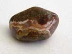
 Black River Harbor
Scenic Byway - Fall Color.
Best Rock Picking and Agate Hunting Beaches in the Upper Peninsula. 
 Hiking Michigan's Upper Peninsula
See Eric Hansen's guide to hiking the Upper Peninsula and other guides for best hiking in the Upper Peninsula [More info]
 Hiking the Minnesota North Shore 7 Peaks
 Porcupine Mountains State Park was voted #2 Best State Park in the U.S.


See our Reviews of Michigan Upper Peninsula Golf Courses around Lake Superior.