 |
 |
|
Pukaskwa National Park on Lake Superior Circle Route
Hattie Cove, Pukwaska National Park Marathon, Ontario
Pukaskwa in Ontario's largest National Park. It is a wilderness area with no roads so its main users are serious back country hikers, long distance canoeists, and kayakers (due to a long Lake Superior coastline). Circle Tour Travelers can sample a part of the park by driving into the Hattie Cove campground.
The road to Hattie Cove is about 5 miles east of Marathon and runs south 10 miles through the First Nation communities of Heron Bay and Pic River. Due to it being a bit off the beaten path, the campground had lots of empty sites. A great place to visit for the day or spend a few days. Hattie Cove itself is protected enough to bring your canoe or kayak. Also sailing and swimming. There are several shorter scenic day hiking trails in the park as well as the 60 km Coastal Hiking Trail.
The day we spent there started out dark and overcast as you'll see from the photos, but ended up much brighter by the time we were through with our hiking. Below the photos are a Map of Hattie Cove and a Link to the park website.
![]()
)
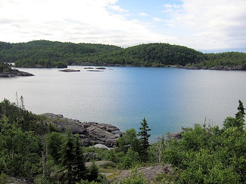
< < < Looking across Hattie Cove to where it empties into Lake Superior.
)
Looking down the length of Hattie Cove from the dock. > > >
)
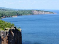
< < < Looking across Pulpwood Harbor from atop the Southern Headland Trail.
)
Jo and Hans take a break on the Headlands Trail.
)
Horseshoe Bay has a nice sand beach, calm waters, and a SW exposure - ideal for an afternoon swim. > > >
)
< < < A rock peninsula jutting out from the mile long western beach.
)
Lush vegetation and wild flowers lined the hiking trails.
)
Pukaskwa National Park Links & Information
)
< < < A map of the central part of the Hattie Cove campground.
Going east and south towards Wawa & Lake Superior Provincial Park
![]() Wawa to Sault Ste. Marie (including Lake Superior and Pancake Bay Provincial parks & waterfalls, hiking, and camping)
Wawa to Sault Ste. Marie (including Lake Superior and Pancake Bay Provincial parks & waterfalls, hiking, and camping)
Going west towards Thunder Bay
![]() Rossport, Terrace Bay and the Ontario North Shore of Lake Superior. (more waterfalls, hiking, and camping)
Rossport, Terrace Bay and the Ontario North Shore of Lake Superior. (more waterfalls, hiking, and camping)
![]() Sleeping Giant Park and Nipigon-Red Rock, Ontario.
Sleeping Giant Park and Nipigon-Red Rock, Ontario.
(some great hiking trails and scenery)
SuperiorTrails.com - Reinhold Development - 2023
Privacy Policy

- Lake Superior Circle Tour
- Minnesota North Shore
- Wisconsin Travel
- Upper Peninsula Michigan
- Michigan Upper Peninsula Travel Directory
- Camping in Upper Peninsula
- Keweenaw Peninsula Scenic Drives
- Copper Harbor - Keweenaw
- Black River Harbor Scenic Area
- Porcupine Mountains
- Pictured Rocks National Park
- Fall Color Porcupine Mountains
- Pictured Rocks National Park
- Tahquamenon Falls State Park
- Winter Events Upper Peninsula
- Ontario Travel
- Travel Resources
- Lake Superior Travel Planner
- Guide to Superior Travel Maps
- Lake Superior Travel Blog
- Lake Superior Golf Course Directory
- Lake Superior Campground Directory
- Finding Lake Superior Agates
- Fall Color Drives
- Fall Color Reports
- Scenic Byways Blog
- SEARCH this site
- Superior Travel Bookstore
- Snow & Weather Reports
- Agates & Beach Rocks
- About Us
Lake Superior Travel Directories
Minnesota Travel
Wisconsin Travel
Upper Peninsula
Ontario Travel
Lake Superior Camping
& Campground Directory
Best Camping along Lake Superior.
 Dramatic Roadside Scenery Rossport to Terrace Bay


Lake Superior Camping
& Campground Directory
Camping along the Lake Superior Circle Drive.
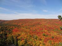
North Shore Fall Colors from the top of Moose Mountain.

Get *free* North of Superior
Travel guides
![]()
Hotel, Motel Lodging
Thunder Bay, Sault Ste. Marie, Ontario North Shore
![]()

Lake Superior Circle Tour Road Map & Guide to Travel Attractions around Lake Superior.

Best Scenic Fall Color Drives around Lake Superior

Ontario Lake Superior Provincial Parks & Campgrounds
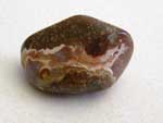 Identifying Lake Superior Agates and Beach Rocks.
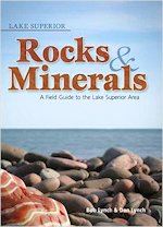
See Our Reviews of the best guides to Lake Superior Agates and Beach Rocks.


See our
Reviews of best Ontario golf courses around Lake Superior.