 |
 |
|
Ontario Travel: Hiking & Waterfalls on the Lake Superior Circle Route - Thunder Bay to Nipigon, Ontario

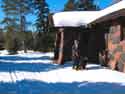
Looking from the Quimet Canyon overlook towards Lake Superior
Traveling north and east of Thunder Bay, the traveler will pass several Gem Shops and mines offering Amethyst - Ontario's most famous gemstone. You'll find the stones in their natural state, as well as embedded in jewelry and craft items. Not too far down the road is the turn-off to Sleeping Giant Provincial Park.
Sleeping Giant Provincial Park - Sibley Peninsula
The park has some terrific hiking trails, including the 40 km Kabeyun Trail that takes you to around the Giant and along the coast of the peninsula. In total there are over 80 km of trails in the park.
)
)
Donna, Jo and I took one of the shorter hikes out to the Sea Lion and back > > >
I had hoped to show more pictures and info here from our 2005 tour, but a last minute change in our itinerary forced us to bypass the Giant on this trip. In 2009, we hope to spend more time here to get more photos and collect more first hand information on its trails and recreational attractions.
![]() Go here for Sleeping Giant Park Hiking Trails & Facility Information
Go here for Sleeping Giant Park Hiking Trails & Facility Information
![]() Campground Map
Campground Map
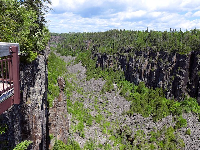
Quimet Canyon Provincial Park
A few miles down Highway 11-17 in the township of Dorion, Ontario and worth a stop and a short hike is Quimet Canyon (500 feet wide and 350 feet deep). The paved road to the park is about 10 km off the main highway. The last part is a steep climb with switchbacks. But before you get to the steep section there is a place where you can park your trailer before beginning the ascent to the top of the canyon.
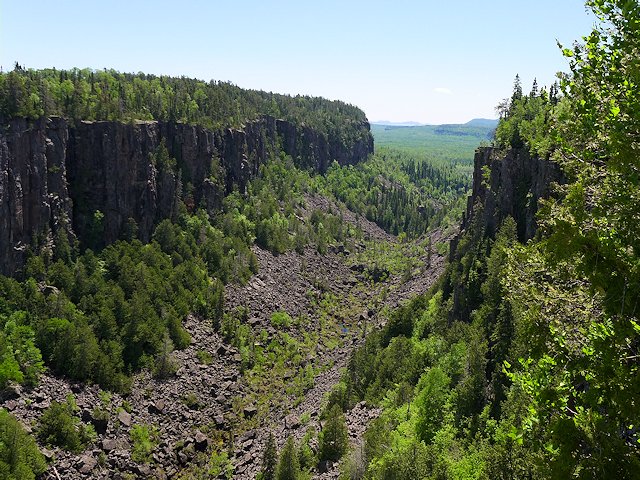
A one KM trail leads to two viewing platforms offering good views of the canyon. At least one of these platforms is wheelchair accessible. The park is day-use only; no camping facilities and limited services.
The micro-climate of the canyon floor is similar to the alpine tundra in Alaska and is a protected area. The vertical columns of diabase rock resisted glaciation while the softer sedimentary rock and soil was carried away to create the canyon. BTW, while some pronounce it "Wee-May" but my sources say "Wee-Met" is correct!
Hiking Trail - Red Rock and Nipigon, Ontario
)
There's a recreational hiking trail system along Nipigon River Bay between Red Rock and Nipigon.
)
Jo and I hiked a portion of it near Red Rock visiting Lloyd's Lookout and the Nipigon Bay Overlook. > > >
For more info on this trail check with the North of Superior Tourism website or drop me a line (roscoetrails@gmail.com) and I'll send you images of the Trail Map. Or if you've got time now, you can download them here: Nipigon Trail 1--- Nipigon Trail 2
There's also what is reputed to be an impressive waterfall on the SE side of Lake Nipigon. It was a little too much of a time consuming detour off the lakeside route for us to check out on our 2004 circle tour - but one of these days we have to make time to see it. If you are interested, the Cascades waterfall is about 50 km north of where Highway 11 and 17 split, the former going north and the latter east towards Rossport.
Going east of Nipigon
East to Rossport, Terrace Bay and the Ontario North Shore of Lake Superior. (more waterfalls, hiking, and camping)
SuperiorTrails.com - Reinhold Development - 2023
Privacy Policy

- Lake Superior Circle Tour
- Minnesota North Shore
- Wisconsin Travel
- Upper Peninsula Michigan
- Michigan Upper Peninsula Travel Directory
- Camping in Upper Peninsula
- Keweenaw Peninsula Scenic Drives
- Copper Harbor - Keweenaw
- Black River Harbor Scenic Area
- Porcupine Mountains
- Pictured Rocks National Park
- Fall Color Porcupine Mountains
- Pictured Rocks National Park
- Tahquamenon Falls State Park
- Winter Events Upper Peninsula
- Ontario Travel
- Travel Resources
- Lake Superior Travel Planner
- Guide to Superior Travel Maps
- Lake Superior Travel Blog
- Lake Superior Golf Course Directory
- Lake Superior Campground Directory
- Finding Lake Superior Agates
- Fall Color Drives
- Fall Color Reports
- Scenic Byways Blog
- SEARCH this site
- Superior Travel Bookstore
- Snow & Weather Reports
- Agates & Beach Rocks
- About Us
Lake Superior Travel Directories
Minnesota Travel
Wisconsin Travel
Upper Peninsula
Ontario Travel
Lake Superior Camping
& Campground Directory
Best Camping along Lake Superior.
 Dramatic Roadside Scenery Rossport to Terrace Bay

Lake Superior Camping
& Campground Directory
Camping along the Lake Superior Circle Drive.
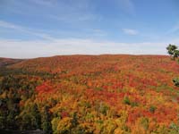
North Shore Fall Colors from the top of Moose Mountain.

Get *free* North of Superior
Travel guides
![]()
Hotel, Motel Lodging
Thunder Bay, Sault Ste. Marie, Ontario North Shore
![]()

Lake Superior Circle Tour Road Map & Guide to Travel Attractions around Lake Superior.

Best Scenic Fall Color Drives around Lake Superior

Ontario Lake Superior Provincial Parks & Campgrounds
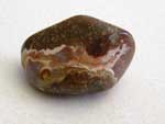 Identifying Lake Superior Agates and Beach Rocks.
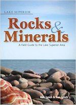
See Our Reviews of the best guides to Lake Superior Agates and Beach Rocks.

)

See our
Reviews of best Ontario golf courses around Lake Superior.