superiortrailssuperior trails
Return to Tettegouche to Temperance River Travel pageReturn to Minnesota North Shore Parks Directory Page
" "


Tettegouche State Park

8 Miles Northeast of Beaver Bay, Mn

Attractions

Facility Information

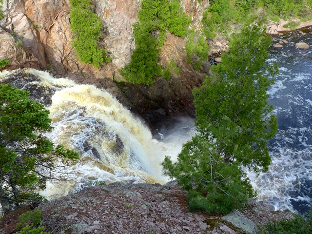
  • 2 waterfalls on the Baptism River
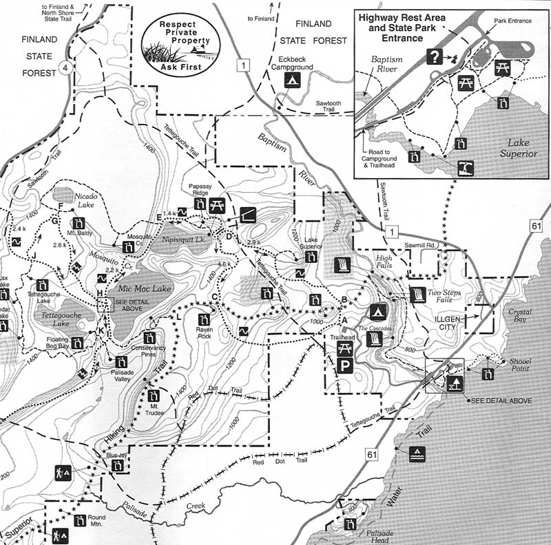
  • 23 miles of hiking trails
  • Class I Wayside and picnic area
  • Full Service Campground
  • Interpretive Exhibits & Naturalist Programs
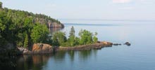
  • Lake Superior Beach
  • Day Use Picnic Areas and Shelters
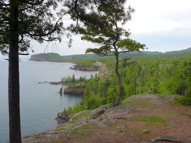
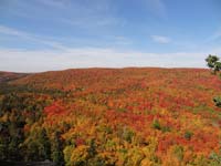
  • Lake Superior Overlooks
  • Winter: cross-country skiing, snowshoe trails, snowmobile trails, and winter camping (modern rest rooms & water in Visitor Center)
  • 34 camp sites, 5 backpack sites
  • 4 back country cabins, 1 lodge
  • RV dump station nearby, but not in park
  • No electric hookups
  • Showers and flush toilets, heated sanitation bldg
  • Some Handicap Accessible Trails with Lake Superior Views
  • Visitor Center open year round
  • Wayside Rest Center: Free 6 hour Parking
  • 218-226-6365
  • www.dnr.state.mn.us/state_parks/tettegouche

Park Hiking Trail Map

  • Shovel Point Trail - 1.4 miles round trip
  • Lake Overlook & Baptism River Loop - 0.5 miles
  • Cascades & Falls Trail - 3 miles round trip from Wayside parking lot
    (much shorter trails from campground, park trailhead parking lot or SHT parking lot on Highway 1)
  • Raven Rock Lookout - 3.6 miles round trip from park trailhead parking lot
  • Tettegouche Lake Overlook - 1.7 miles round trip from Cty Rd 4 parking lot
  • Tettegouche Camp on Mic Mac Lake - 1.5 miles from Cty Rd 4 parking lot

tettegouche state park trail map

Some Tettegouche Park & Baptism River Waterfall Pictures